

The primary objectives of the National Geospatial Mission, announced in the Union Budget 2025–26, are to establish essential geospatial infrastructure and data, modernize land records, strengthen urban planning, and aid in infrastructure development.
Through this workshop, the Survey of India aims to bring together stakeholders from central/state government, industry, academia, and research to engage in focused discussions and deliberations on the role of geospatial infrastructure and data using latest Geospatial technologies in shaping the ‘Viksit Bharat’.
In line with this objective, the event’s theme has been decided as the “ Geospatial Mission: An Enabler of Viksit Bharat. ”
Dr. Jitendra Singh, Hon’ble Minister of State (I/C), Ministry of Science & Technology, Ministry of Earth Sciences, Prime Minister’s Office, Ministry of Personnel, Public Grievances and Pensions, Department of Atomic Energy and Department of Space, will be gracing the event as the Chief Guest.

| Session | Timings | Speaker Name | Designation / Organisation | Photo |
|---|---|---|---|---|
| Inaugural session | 10:15 am – 11:00 am | Sh. Hitesh Kumar S. Makwana | Surveyor General of India |  |
| Sh. Srikant Sastri | Chairman, GDPDC |  |
||
| Dr. Abhay Karandikar | Secretary, DST, Govt. of India |  |
||
| Sh. Lochan Singh Pathania | Chief Hydrographer, NHO |  |
||
| Dr. Jitender Singh | MoS (I/C), Ministry of Science & Technology | 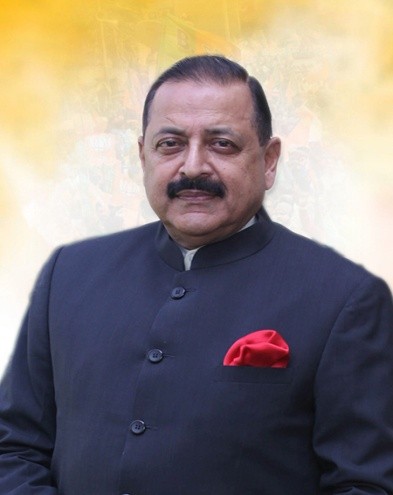 |
||
| Session-1 Modernization and Strengthening of National Geodetic Reference Frame | 11:30 am – 12:45 pm | |||
| Prof. Onkar Dikshit | Coordinator, NCG, IIT Kanpur |  |
||
| Sh. G Varun Kumar | Additional Surveyor General, Survey of India |  |
||
| Cdr. Prashant Kumar Srivastava | Scientist ‘G’, MoES |  |
||
| Dr. Balakrishnan Nair T. M. | Director, INCOIS |  |
||
| Sh. Sajid Malik | CMD, Genesys International Corporation |  |
||
| Mr. Olivier Casabianca | Vice President, Trimble |  |
||
| Session-2 Strengthening of Geospatial Data and Mapping Infrastructure | 12:45 pm – 2:00 pm | Sh. Srikant Sastri | Chairman, GDPDC | |
| Dr. Manabendra Saharia | Associate Professor, IIT Delhi |  |
||
| Sh. S. V. Singh | Additional Surveyor General, Survey of India |  |
||
| Dr. Prakash Chauhan | Director, NRSC |  |
||
| Sh. Rohan Verma | Director, MapmyIndia & MD, Mappls DT |  |
||
| Sh. Seeram Sambasiva Rao | Special Secretary, Govt. of Kerala |  |
||
| Dr. Yury Filippov | Roskadastr, Russian Federation |  |
||
| Session-3 Role of Standards in harmonizing geospatial frameworks | 03:00 pm – 04:15 pm | Dr. Debapriya Dutta | Chairman, LITD 22 (BIS) |  |
| Dr. Rajendra Gaikwad | SAC Ahmedabad |  |
||
| Sh. Sandeep Shrivastav | Additional Surveyor General, Survey of India |  |
||
| Sh. Nikhil Kumar | President, AGI |  |
||
| Sh. Sanjay Sinha | Senior Consultant, Govt. of Andhra Pradesh |  |
||
| Cmde. Mathew G Abraham | National Hydrographic Office |  |
||
| Dr. Zaffar Sadiq Mohamed-Ghouse | Vice President, Woolpert & Vice Chair, OGC |  |
||
| Session-4 Keeping pace with technological advancements in Geospatial fields | 04:45 pm – 06:00 pm | Sh. Abhishek Singh | DG, National Informatics Centre |  |
| Sh. Alok Prem Nagar | Additional Secretary, Ministry of Panchayati Raj |  |
||
| Sh. Kunal Satyarthi | Joint Secretary, Department of Land Resources |  |
||
| Sh. Shailesh Kumar Sinha | Additional Surveyor General, Survey of India |  |
||
| Dr. Roshan Srivastav | Associate Professor, IIT Tirupati |  |
||
| Sh. Agendra Kumar | Managing Director, Esri India |  |
||
| Mr. David Henderson | Chief Geospatial Officer, Ordnance Survey UK |  |